
Trace a West Seneca Street by Address
A useful West Seneca street search is a document trail, not a street-wide roll. Erie County Real Property Tax Services and On-Map can start with an address, owner name, or SBL, the section-block-lot identifier. The returned parcel supplies a situs address, an owner of record, and often a deed date or Book/Page bridge. From there, the Erie County Clerk can document the recorded transaction, while a correct-year directory can supply an older listed household. Each source answers a narrower question. An assessed owner may be an estate, trust, or entity, and an owner mailing field is correspondence information rather than proof of who is present at the property.
- Use the known address in the Erie County property-search entry point or in On-Map. Record the parcel's address, PIN or SBL, owner field, LOCALZIP, and any Book/Page reference shown.
- Open the same result in Erie County On-Map to inspect the parcel outline, roads, municipal boundary, and the adjoining polygons one at a time.
- Use the parcel's Book/Page, file number, party name, or legal-description clues in the Erie County Clerk's BrowserView record index. Select West Seneca where the town field is useful.
- Read the deed metadata for the direct and indirect parties, instrument number, recording date, and legal description. Those fields are stronger links than a street-name guess.
- For a dated historical listing, ask the Grosvenor Room for the right Haines, suburban, or town-arranged volume. The West Seneca city directory collection identifies the historical shelf in more detail.
Keep a note of the date and source beside every result. A deed date, a tax-roll date, and a directory year describe different moments in the history of a West Seneca street.
West Seneca Street Directory Parcel Fields
The county parcel layer supplies the practical vocabulary for an address search. PIN is the longer county parcel identifier, while SBL is the section, block, and lot reference without the county SWIS prefix. ADDNUM, ADDNAME, and ADDRESS describe the situs, meaning the physical location of the parcel. OWNER1 and OWNER2 are assessment fields. MAILAD1, MAILAD2, city, ZIP, and ZIP4 belong to the owner's mailing record. LOCALZIP is the property ZIP, not necessarily the owner's mailing ZIP. Book and Page can help with a recent sale, though the County says those references are available only for sales in roughly the last 10 to 12 years.
| West Seneca search field | County use | What to record |
|---|---|---|
| Address | On-Map address query, configured as ADDRESS | Situs location, not a mailing address |
| Owner | On-Map owner query, OWNER1 contains | Assessed owner name, which can be an entity or trust |
| SBL | On-Map SBL query and tax-map bridge | Section-block-lot identifier for parcel and legal-description work |
| PIN | Parcel identifier route | County SWIS prefix plus section, block, and lot components |
| Book / Page | Clerk-record bridge | Recent transfer reference, if present in the parcel data |
The official Erie County parcel schema shows the address, owner, mailing, local-ZIP, tax, and building fields available in the public layer.
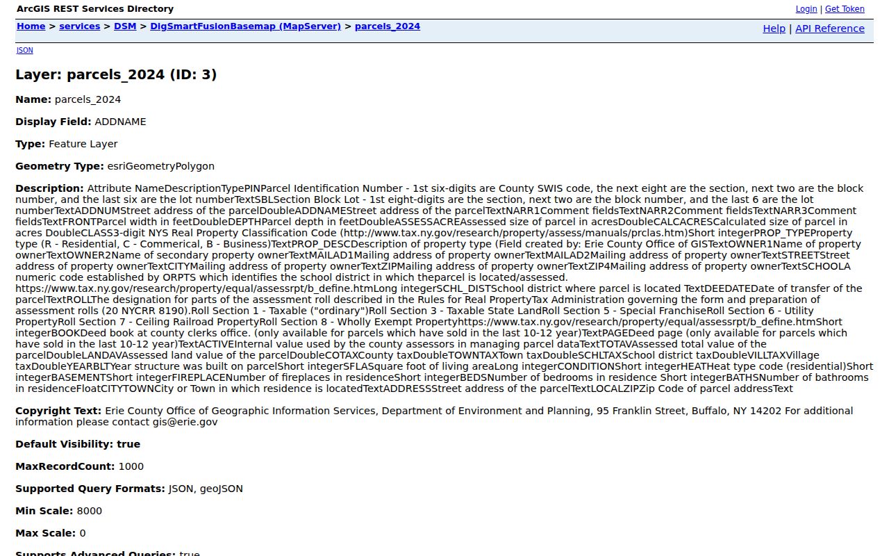
Field availability is not a promise that every parcel has every field filled in. The schema also makes the key distinction clear: a mailing value can be useful for correspondence while remaining separate from the West Seneca property address.
- Parcel
- A mapped unit of land used in the assessment and tax system. It is not a list of all people connected to that place.
- Situs address
- The physical street location carried in the parcel data, such as the place where the building sits.
- Plat or map reference
- A recorded map or subdivision reference that can help match land when a street address is missing or has changed.
- Criss-cross directory
- A reverse address directory that can connect an address to a listed name for the correct historical year and coverage area.
Use West Seneca Street Parcel and Map Searches
Erie County's Tax Inquiry and Parcel Search is the current property starting point, while On-Map supplies the geographic context. The tax portal's public navigation includes Tax Inquiry and Parcel Search. On-Map lets a reader view tax parcels, aerial photography, Pictometry, streets and highways, municipal boundaries, ZIP polygons, school and legislative districts, wetlands, soils, and flood-related layers. Its parcel data are current to 2025, and the County describes the viewer as a viewing and querying tool rather than a legal survey. The map is a way to form a better record request, not a substitute for a deed, tax map, or survey.
The Erie County Tax Inquiry and Parcel Search landing screen directs a user to the county's property and tax functions.
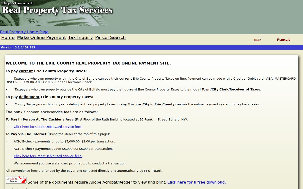
Begin with one known parcel and write down its stable identifiers before moving to another address. That practice avoids confusing similar road names or attaching an old document to the wrong lot.
The Erie County On-Map viewer displays the parcel, aerial, and map-tool environment used to place that record in context.
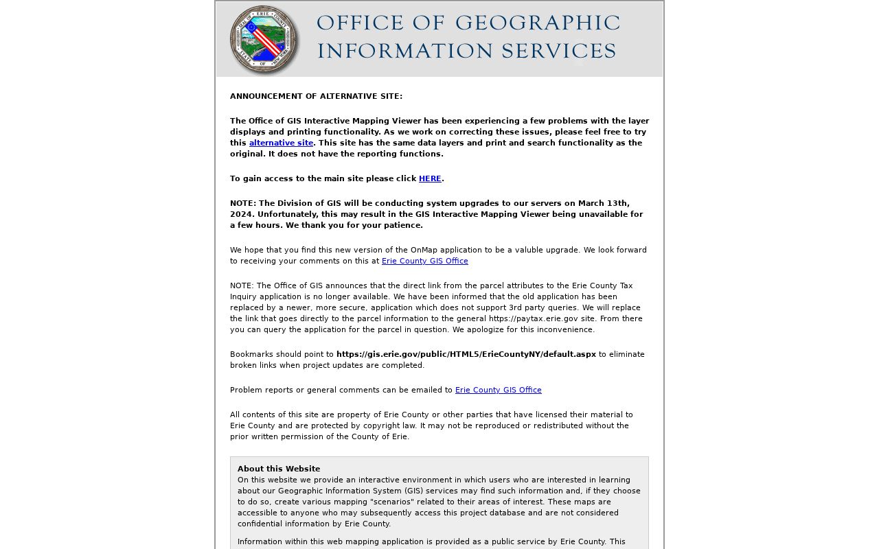
For a block question, search the first address, zoom to its polygon, and inspect each touching parcel separately. No source reviewed for West Seneca confirmed a public radius, buffer, bulk-neighbor, or all-properties-on-a-street control in the public viewer.
West Seneca Street Directory Meets the Clerk Index
BrowserView is the important address blind spot in a West Seneca street directory. The Clerk's official-record search has party name, document type, town, date, consideration, instrument number, Book/Page, lot/block, legal-description, map, and parcel search modes. It does not offer an ordinary street-address search. Use the parcel result to carry a Book/Page, file number, SBL, or legal-description clue into BrowserView. If only a party name is available, the field expects last name first, with no comma; narrowing by Town of West Seneca, date, and document type can then reduce the results.
The Erie County Clerk Official Records Public Search shows the index modes that bridge a parcel record to a recorded instrument.
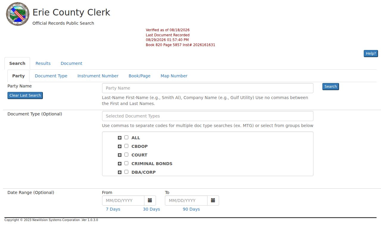
Document detail can show type, instrument number, date and time, Book/Page, pages, consideration, map or parcel fields, town, direct and indirect parties, notes, and linked documents. Some images can be restricted or unavailable, so an online hit may supply metadata only. Deeds are held from 1808 onward, with online party indexing from January 1, 1986 and online deed images from January 1, 1960.
West Seneca Street Records at Each Address
A West Seneca street can leave different traces with different custodians. The parcel record is current assessment context. The Clerk records the legal transaction. Code Enforcement can hold address-specific work files. Historical volumes can show a dated listing when their coverage fits the place and year. These sources should be compared, not merged into a claim that every non-owner occupant is public.
| Address-keyed source | Keeper | West Seneca result | Access boundary |
|---|---|---|---|
| Tax inquiry / parcel search | Erie County Real Property Tax Services | Address, owner of record, SBL, and tax information | Public property entry point; search by address, owner, or SBL |
| On-Map | Erie County GIS | Parcel polygon, roads, owner and mailing attributes, LOCALZIP, and layers | Owner, address, or SBL query; no verified bulk street tool |
| Final tax roll | West Seneca Assessor | Owner, mailing, situs, class, values, exemptions, and Book/Page fields | Annual public PDF and Assessor counter; owner-of-record information |
| Recorded instrument | Erie County Clerk | Parties, consideration, recording date, and legal description | Use a parcel or document bridge, not an address search |
| Permit or code file | West Seneca Code Enforcement | Owner or applicant, work address and type, estimated cost, and inspection history | Counter or FOIL request; no online case search verified |
| Historic directory | B&ECPL Grosvenor Room | Dated listed name, address, and sometimes an address-to-name relation | Use a West Seneca-capable title for the correct year |
Parcel work has a clear Town and County split. The Town maintains its own assessment and Code Enforcement functions, while county records hold the tax/GIS layer and recorded land instruments. The Town's FOIL route is for Town material and explicitly does not maintain police or court records.
Note: A current record, a past deed, and a printed directory entry can all be accurate while describing different dates and different connections to the same address.
West Seneca Street Permit and History Clues
Code Enforcement files are a parallel address trail rather than proof of title. The Town's 2026 permit application calls for a work address and SBL, owner or contractor applicant, contact information, cost, building or work type, insurance, and inspection details. Its categories include erecting, altering, repairing, extending, demolishing, sheds, driveways, garages, pools, decks, reroofing, fences, and egress windows. A focused request should name the address, time span, permit number if known, record category, and whether inspection or copies are wanted. No public permit database or current local fee table was verified.
For historical streets, start with the correct locality name as well as the address. West Seneca was organized as Seneca in 1851 and renamed West Seneca in 1852. Historical catalogs and directories may also use Ebenezer, Gardenville, Blossom, or older parent-town contexts. The Grosvenor Room directory guide identifies Haines coverage for all Erie County from 1968, town-arranged voter directories from 1926 to 1971, and suburban titles useful for later West Seneca research.
There is no verified town-wide street-renumbering or renaming project with a date in the available research. Searching the older town and hamlet names is supported; inventing a new address conversion is not.
West Seneca Street Record Desks
When an online result ends, the address trail continues through the office that created the record. The West Seneca Town Clerk is the Records Access Officer for Town material, while Code Enforcement can receive a request for a permit, plan, inspection, certificate, or notice at a specified address. A Town request should name the street address, date range, record category, and desired inspection or copy. It is not the route for police or court records. Erie County Clerk’s historic-record counter at 92 Franklin Street in Buffalo is the fallback for older deed books or a document request when BrowserView metadata is not enough.
For historical household evidence, the Grosvenor Room can help identify the right Haines, suburban, voter-directory, map, or newspaper resource. This three-part access chain, Town office, County Clerk, and library collection, is more useful than repeating a portal search that cannot reach the underlying record.
West Seneca Street Postal Context
Postal labels need the same care as parcel fields. Erie County’s map data carries LOCALZIP for the property’s ZIP, while the owner mailing fields can carry a different city and ZIP. A West Seneca street can also meet a Buffalo, Depew, Elma, or Orchard Park postal label near a boundary. Those labels route mail; they do not change the Town record or prove where an owner or household member lives. Check an individual delivery address through USPS when the postal ZIP matters, then use the parcel’s situs, SBL, and City/Town fields for property research.
For a ZIP-specific explanation of the touching polygons and the USPS confirmation step, use the West Seneca ZIP Code Directory. Street research still proceeds parcel by parcel, even after the postal geography is clear.
West Seneca Street Voter-Record Limits
New York's VoterLookup is a person's own registration tool, not a street-by-street public tool. It requires a registered voter's last name, first name, date of birth, county, and address information to return that matching record's registration, poll-site, or mail-ballot information. The public material reviewed does not offer by-street browsing, a list export, or another person's result. Election Law §3-103(5) also limits voter-registration data to an elections purpose. That rule matters even when a property address is already known.
Historic voter-registration directories at the library are different. B&ECPL holds town-arranged Erie County volumes for 1926 through 1971, which can supply a dated historical lead when the exact town and volume fit. They are not a current street list and never reveal ballot choices. Confidential voter registrations under Election Law §5-508 remain outside public inspection and copying for four years, subject to renewal.
West Seneca Street Directory Privacy Limits
Address records do not disclose every household connection. Parcel files identify assessed ownership and mailing information, not every non-owner occupant. Utility and delivery-customer information are not general public rolls, and New York motor-vehicle records are restricted by the federal Driver's Privacy Protection Act. Protected addresses can also reflect the New York Address Confidentiality Program under Executive Law §108, while confidential voter records have their own protection. A missing name is not evidence that a person has no connection to an address.
Use a street record for personal, lawful research such as checking a parcel's public history, documenting an estate trail, or placing a dated historical listing in context. Return to the custodian when a document is unclear or a record has changed.